
Franz Creek Bridge Replacement
What’s Happening?
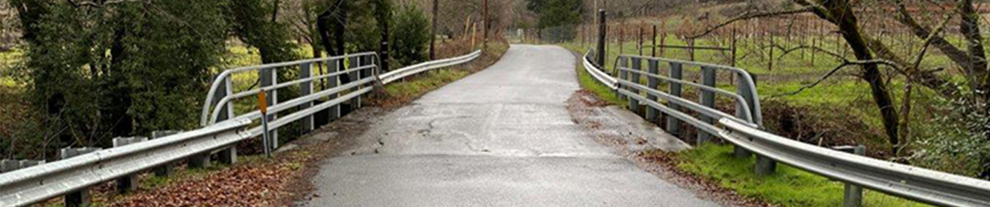
Sonoma County plans to replace the one-lane bridge over Franz Creek on Franz Valley School Road.
Location: Franz Valley School Rd (Lat/Lon: 38.583731, −122.671856)
The new bridge will be a single-span (no piers in the creek), cast-in-place reinforced concrete box girder with:
- Two 10-ft lanes
- One 5-ft shoulder and one 1-ft shoulder
The bridge will be built upstream (south) of the current bridge on a new alignment. The existing bridge will stay open during construction and then be removed after the new bridge opens.
How We Got Here
Regular inspections show the current bridge is near the end of its service life.
- Erosion (scour) from the creek is undermining the foundations.
- Caltrans’ October 2022 inspection gave a sufficiency rating of 34.6/100 (bridges under 50 are candidates for replacement).
- A hydraulics report (Aug 28, 2013) found the bridge scour-critical, meaning higher risk during major storms.
The County reviewed options and determined that rehabilitation isn’t feasible due to the foundation erosion, construction complexity, cost, and in-stream environmental impacts.
Why It Matters
Replacing the bridge will:
- Improve safety and reliability in storms and earthquakes.
- Maintain emergency response and everyday access for residents, cyclists, and pedestrians.
- Protect the creek by removing in-stream piers and allowing water to flow freely.
- Reflect the rural setting through design choices guided by community input.
What’s Next
The project is in the environmental review (NEPA/CEQA) phase with studies underway. Targeted milestones include:
- NEPA clearance: Fall 2025 (planned)
- CEQA clearance: Fall 2025
- Permitting & right-of-way: 2026–2027
- Construction: Target 2028, planned to occur in a single construction season (subject to change)
Design and Alignment
- New alignment mimics today’s roadway while meeting modern safety standards (lane/shoulder width, sight distance, barrier rail).
- Design speed reduced to 25 mph (special Caltrans approval) to match the area’s curves and calm traffic (average current approach speed ~39 mph).
- Bridge length ~80 ft; width ~30 ft (two 10-ft lanes + 5-ft shoulder + 1-ft shoulder). The wider shoulder supports safe stopping sight distance on the curve.
- No permanent lighting is proposed.
- Retaining walls are avoided; approaches use graded embankments (with a short wingwall on the west).
- Tree removal is minimized; required replanting will occur per permits.
- Aesthetics: natural colors/textures and architectural features will be refined with community input.
Timeline (high-level)
- 2018–2021: Alternatives developed; three alignments presented to the community (red/blue/green).
- 2021: Community input led to the refined “green” alignment; public exhibit on concrete colors/textures (Sept 13–19, Alexander Valley Hall).
- 2023–2025: Environmental studies and documentation; NEPA/CEQA processing.
- 2026–2027: Permits and right-of-way acquisition.
- 2028: Construction (target), with the old bridge kept open during work and removed after the new bridge opens.
FAQs
Is the current bridge safe?
Yes, based on current information. Caltrans inspects it every two years and the County monitors it. If it becomes unsafe, it will be closed and detours arranged.
Why replace instead of repair?
Foundation scour makes repair infeasible and cost-prohibitive, and major in-stream work would have larger environmental impacts.
Why not keep the same alignment?
The existing alignment doesn’t meet modern safety standards (width, design speed, sight distance, railings). The new alignment is as similar as feasible while meeting today’s requirements and reducing flood/erosion risks.
Why not move the bridge farther north?
A northerly alignment would raise speeds, costs, and environmental impacts and didn’t match community priorities.
Can right-of-way needs be reduced?
The current (green) alignment requires the least additional right-of-way compared to earlier options. The County negotiates in good faith and compensates at fair market value. If opportunities arise, the team will further minimize right-of-way where possible.
Will visibility and safety improve?
Yes. The proposed alignment meets visibility standards and improves sight lines compared to today.
What about bikes/pedestrians during construction?
The existing bridge stays open, allowing people to bypass most construction.
Noise and construction impacts?
Temporary and planned for one season; impacts and mitigations are evaluated during environmental review.
How is the project funded?
Through the Federal Highway Bridge Program (HBP), administered by Caltrans Local Assistance; preliminary estimate: $7,000,000.
Get Involved / Contact
Questions or comments? Please contact Chet Jamgochian: chet.jamgochian@sonomacounty.gov.
 Translate